Weather alert-Cold wave and snowstorm in New York, Chicago disrupt travel plans post Thanksgiving; check NWS advisory
A new snowstorm is set to hit large parts of the United States early this week, potentially disrupting post-Thanksgiving travel for millions returning home after the Nov. 27 holiday.
Cold air moving into the Northeast, Mid-Atlantic, Midwest, and Central Plains could trigger snowstorms producing a mix of snow, sleet and rain, AccuWeather meteorologists said, according to USA Today.
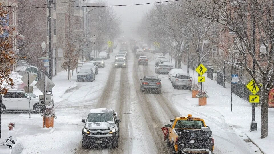
Forecasters warn that some areas could see up to 6 inches of snow by Tuesday, complicating road and air travel just days after another system dropped over a foot of snow in parts of the Midwest. As of 11 am Sunday, over 560 flights in the US, comprising departures, arrivals, and domestic routes, had been canceled, as per FlightAware.
AccuWeather Meteorologist Alyssa Glenny warned that travelers should prepare for disruptions over the holiday weekend, noting that crews could have difficulty keeping up with heavy snow on roads and highways throughout the Midwest and Great Lakes. She also mentioned that this stormy and cold pattern is likely to persist into the first week of December.
“A winter storm will approach the Mid Atlantic and Northeast beginning Monday evening with a threat of snow and ice across the interior portions of both regions. Any snowfall and ice will present hazardous travel concerns, especially across the interior Northeast US,” NWS Weather Prediction Centre said on X.
Meanwhile, Chicago’s O’Hare International Airport recorded more than 8 inches of snow Sunday morning. Passengers traveling through major Midwest airports such as Chicago, Detroit, Denver, Minneapolis, St. Louis, and Kansas City may experience substantial delays and flight cancellations.
A winter storm will approach the Mid Atlantic and Northeast beginning Monday evening with a threat of snow and ice across the interior portions of both regions. Any snowfall and ice will present hazardous travel concerns, especially across the interior Northeast U.S. pic.twitter.com/ihA8xWyyS2
— NWS Weather Prediction Center (@NWSWPC) November 30, 2025
New Yorkers could face a tricky commute Tuesday morning as a Nor’easter moves in during rush hour, with suburbs potentially receiving up to 3 inches of snow. The storm is expected to reach the city around 6 am bringing a wintry mix of snow and rain that may make roads slippery for those returning from the holiday weekend. In the city, snow is unlikely to accumulate and should turn to rain by 9 am, according to FOX meteorologist Cody Braud.
“NYC is likely to get a continuous 12-16 hours of rain and or snow. Both the morning and evening commutes will face impacts,” New York Post quoted Braud as saying. Temperatures are expected to remain in the mid-30s to low 40s throughout the day, with snowfall likely staying under half an inch and not lingering on the ground. New York City could also see up to 2 inches of rain.
According to AccuWeather, the fast-moving snowstorm is forecast to bring snow and a mix of sleet to Kansas, southern Nebraska, and much of the East Coast, including Pennsylvania, New York, northern New Jersey, and New England between Monday and Tuesday. Lundberg added that AccuWeather meteorologists are keeping an eye on at least two more potential storms expected in the first half of December.